A winter snow at Horton Grove Nature Preserve by Kyle Obermiller As I enter my…

When you grow up within a rocks throw of Pisgah National Forest, you end up being one of those people who would rather spend their weekends camping, spending nights under the stars around a campfire instead of inside on the couch. There’s just something about the smoke rising into the night sky, the smell of the campfire, and the company of good friends that makes a fire the pinnacle of any camping trip.
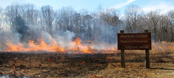
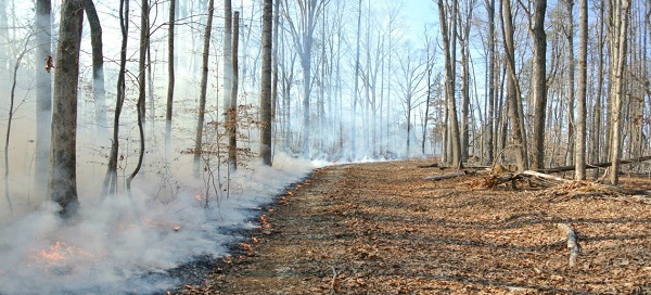
As you probably are aware of by now, we had a larger version of a campfire at Horton Grove a few weeks ago in the form of a prescribed burn. After all the smoke had settled, about 20 acres of the grassland and mixed pine/hardwood forest south of the main parking area, as well as approximately 26 acres of hardwood understory across Jock Road from the parking lot, were burned. Through using prescribed fire as a management tool, land managers can mimic what used to be a natural disturbance that helps maintain unique ecosystems, including the native grassland and pine savannah restoration areas we have at Horton Grove.

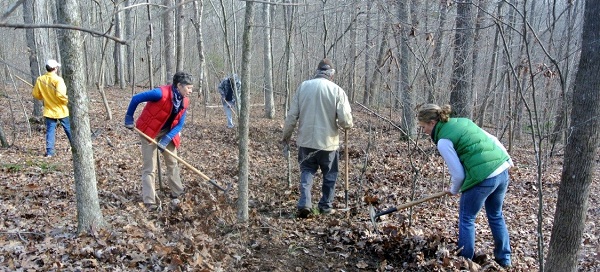
This whole process starts many weeks before the actual burn. Following standards set forth by the North Carolina Prescribed Burning Act, TLC staff wrote burn plans for both the grassland and hardwood areas. The burn plan sets forth specific weather parameters such as humidity, wind speed and direction, and temperature which must be met in order to safely complete the burn. Just two days before the burn, the forecast fit the needed conditions and we decided to set the date. On the morning of the burn, a call to the N.C. Forest Service confirmed our weather conditions were good to go. We started out at 9 a.m., with three TLC staff, one burn contractor, and many excited volunteers. It took a few hours to clean all the firelines that would contain our burn.
At 11 a.m., we all came together for the safety briefing. After crossing all our T’s and dotting all the I’s for the burn, it was time to lay down some fire! All the volunteers, staff, and the contractor worked together like a well-oiled machine, using drip torches to light the firelines throughout the burn, patrolling the burn to catch any pesky embers trying to escape the burn area, and using water pumps to keep our fences from falling victim to the burn.
After just a few short hours, 2/3 of the area was blackened and mop-up procedures were undertaken to put out any smoldering debris, a final effort to ensure no fire will escape the area it was meant to be in. I know the black burned areas may be an unwelcome sight for many people, but I encourage you to go out and view these areas periodically throughout the year as their transformation will be marvelous. When you visit, stand in the parking lot and look north into the thick grassland, then look south into the freshly burned area. For reference, the area to the north was burned in late March of 2014, just 10 months ago! When you enter the Peaks Loop trail off of Jock Road, know that the areas to the left and right were also burned in March 2014 and look now at the changes in the understory. The burns help to promote oak and hickory regeneration in these stands. It’s also interesting to note that the hardwood burn areas from March 2014 had an impressively high number of mushrooms observed growing in the understory during the wet months last summer and fall.

In the next few months, we will be moving into the burned grasslands and group openings along the Hart Trail planting Shortleaf pine among the burnt brambles and sweetgum, but I’ll save that story for another time. This is The Dirt- Tales from the Field¬, a blog hot off the press that brings you the inside scoop of the work we do at the places you love. As always, I encourage you to send an email my way, kobermiller@triangleland.org, with any questions or comments you have. Who knows, it may end up being the subject of a future blog!
